NTVLC-01 Blackspur Creek wetlands
Link to Bird Life Australia Birdata Shared Site here
Survey type: 2ha, 20 minute search
Description
The confluence of the Tarwin River and the Blackspur Creek is a seasonal remnant wetland currently compromised by weed (willow) infestation and inappropriate drainage. This area contains remnant Swamp Scrub and Wetland vegetation and will be managed as an endangered Strzelecki Gum habitat as an offset for major road works in the area. Habitat improvement should lead to biodiversity gains. This bird monitoring site will help us understand how habitat rejuvenation impacts bird numbers and the time frame from works to environmental recovery.
Site Location
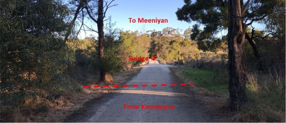
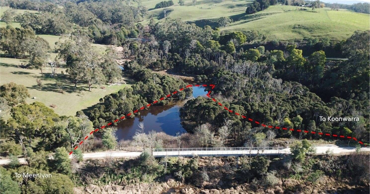
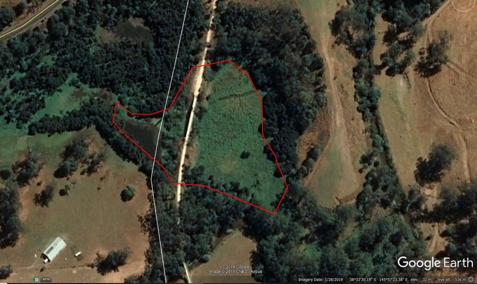
Getting there: The confluence of the Black Spur Creek and the Tarwin River is located south of Koonwarra. The site is accessed via the Great Southern Rail Trail. Either walk south down the rail trail from the Koonwarra township or the Recreation Reserve. To get to the Recreation Reserve from Koonwarra, travel south on the South Gippsland Highway (A440) for 280 metres turn left then after 30 metres, right down Buckingham and Fowlers Road. The reserve is 225 metres on the left. Parking is available at the reserve and access to the rail trail is on the other side of Buckingham and Fowlers Road. The Black Spur Creek bridge is 1 kilometre along the rail trail. The monitoring site starts 30 metres before you reach the bridge over the creek and wetland, in a group of trees, mainly black wattles just before you get to the bridge.
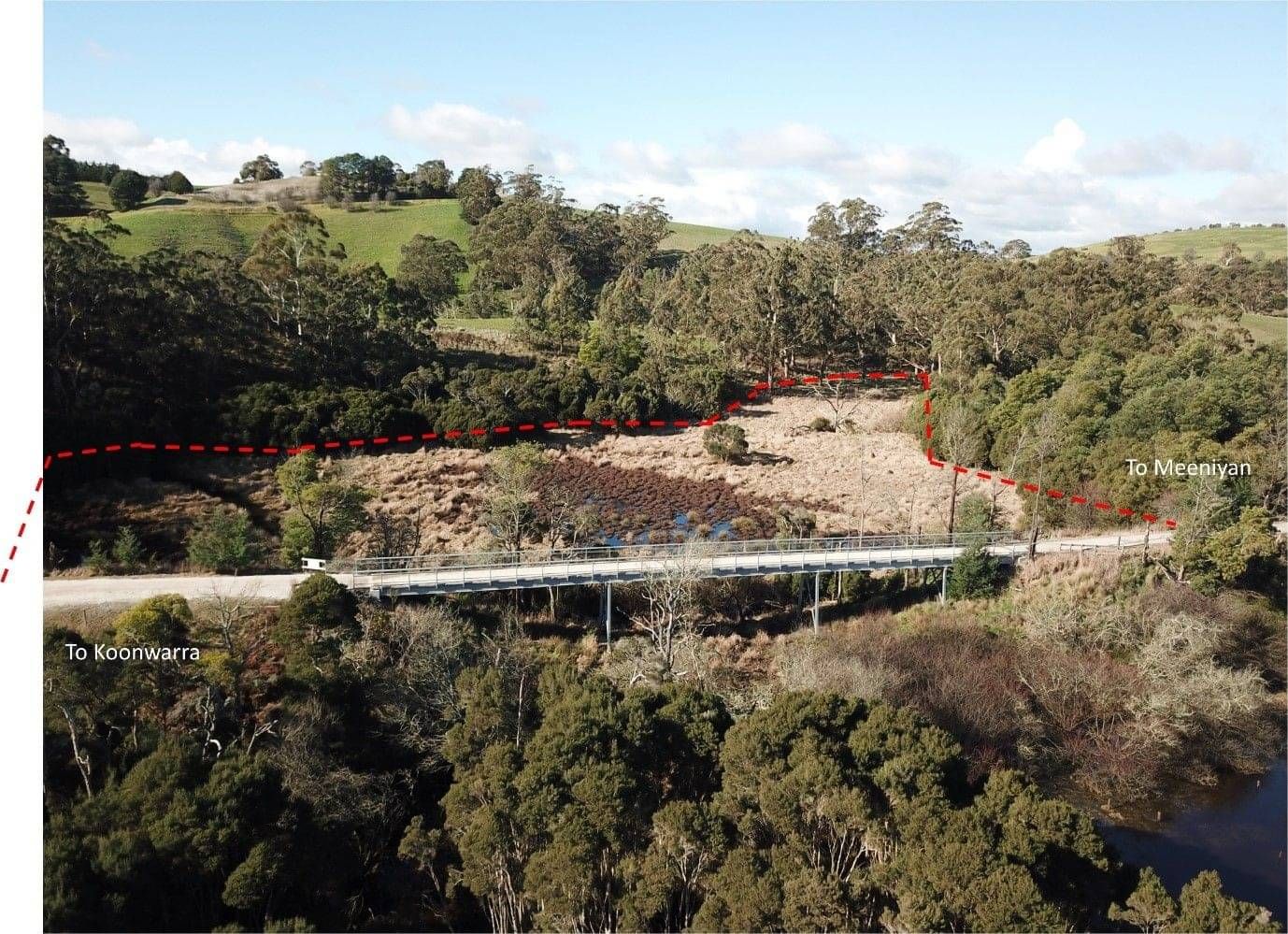
As you walk towards the bridge, the vista to both sides of the rail trail opens up and gives good views of this freshwater wetland. It is possible to observe the whole monitoring site from the Black Spur Creek bridge. To the east the site is the clearly bounded by the surrounding trees and scrub.
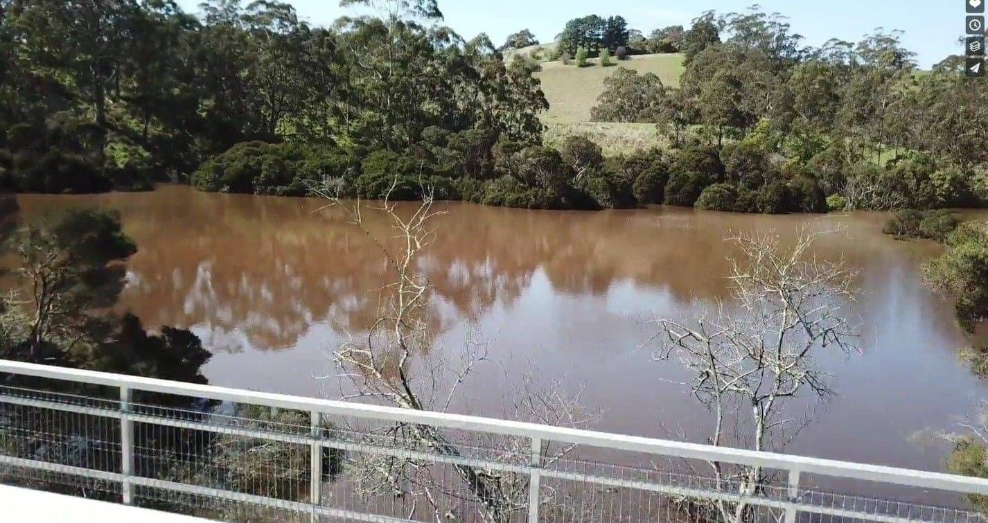
Don’t forget it is a wetland and often looks like this!
To the west the monitoring site includes all the open area visible from the bridge and the more open area before the bridge on the northern boundary of the site. Survey to the edge of the larger trees in this portion of the site. Don’t forget it is just the wetland we are monitoring, the farmland you can see through the trees to the south west is not included.
Survey Method
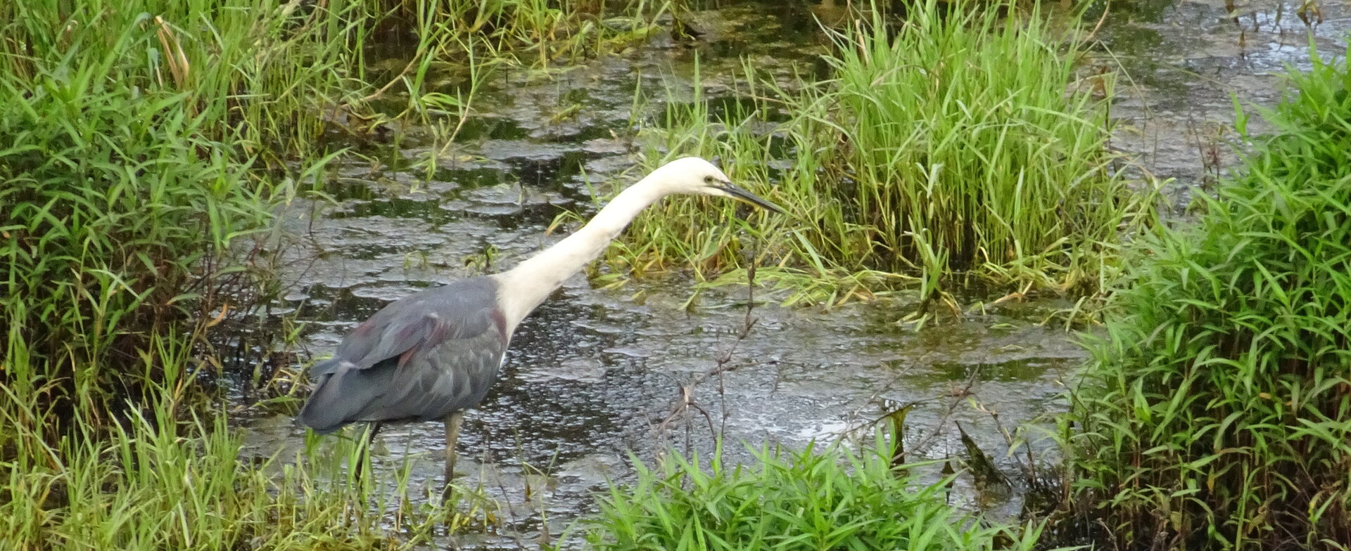
20 Minute 2 Hectare search: walk along the bridge looking out over the wetland in both directions. The site is clearly bordered by trees at the edge of the 2 Ha area. Be sure to look down, as many small birds fly under the bridge, in the safety of the willows. These will be removed in the first part of the wetland rehabilitation and replaced by indigenous endemic species. Monitoring will allow us to see if birds return after weed removal and revegetation. Waterbirds are common when the wetland contains water, and sacred kingfishers sometimes seen here. Listen too; small birds including parrots can usually be heard calling in the Melaleuca scrub. Record the species present and the number of birds of each species.
Use the Birdata website or the Birdata phone app to record sightings. https://birdata.birdlife.org.a...
Acknowledgement of Traditional Owners and Country
The Nerrena/Tarwin Valley Landcare group acknowledges the Traditional Owners of the Landcare group area and pays respect to their past and present Elders. We honour and celebrate the spiritual, cultural and customary connections of Traditional Owners to country and the biodiversity that forms part of that country.
Contact us
Sue, Landcare group President
Phone 0432 379 119
Landcare group Secretary
Email: ntvlandcare@gmail.com
Mailing address:
105 Stockdales Road, Koonwarra 3954
Send us a message