Creating a farm map in Google Earth
Creating a Whole Farm Plan
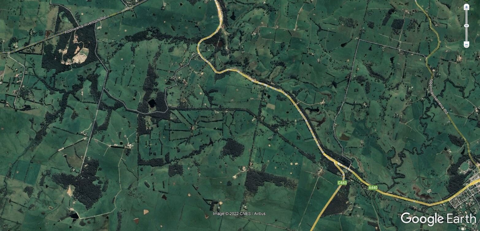
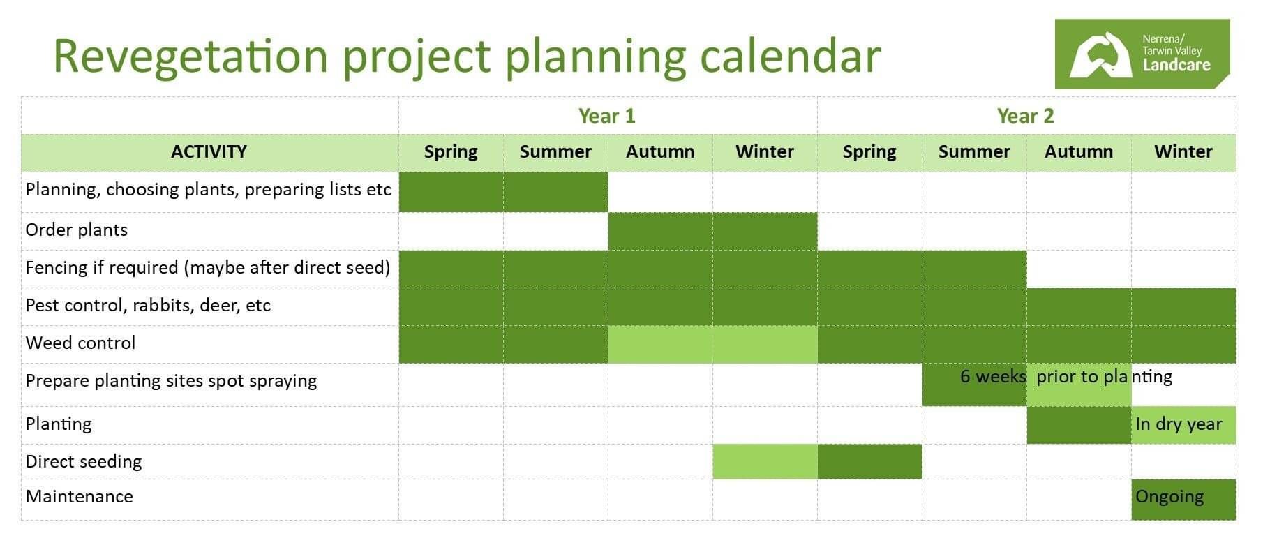
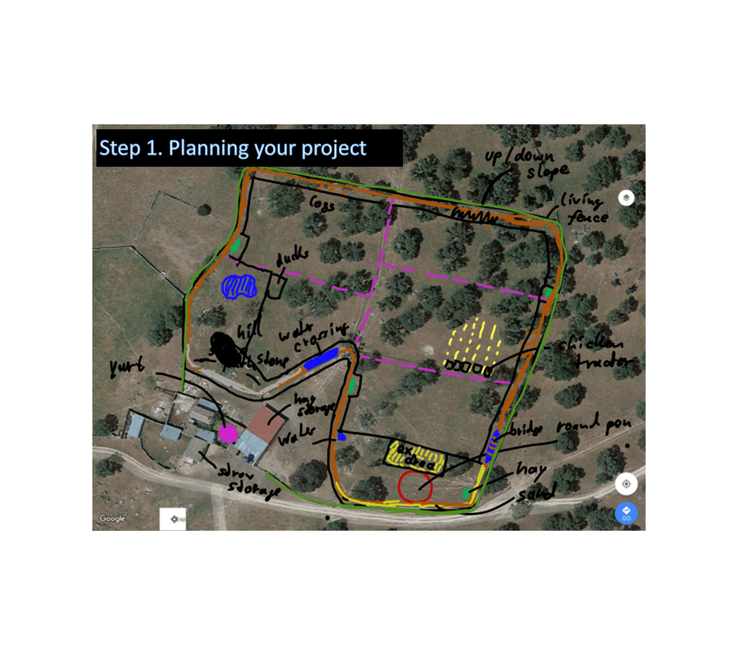
Projects are successful because of good planning. Projects that involve establishing native vegetation are no exception. Do you have a whole farm plan? When working out what goes where on your property a whole farm plan is invaluable. Landcare sometimes runs whole farm planning courses (Farmplan 21) however you can do a farm plan on your own using online resources and map layers in Google Earth. Use your farm plan to plan where you want tree breaks and areas of protected vegetation. Set priorities for the order of the works.
Here is a handy land management template from Bass Coast Shire council. Whilst not a farm plan per se this template can be useful as a planning tool. This tool works through process of land use planning in which natural properties (and hazards of use) of a farm are assessed. The farm enterprises and management are then designed to match the land’s potential and limitations.
Here are links to the Bass Coast Planning guide (PDF 291kb) and a Land Management Plan Template (PDF 196kb).
The template includes:
- Summary of land management issues – erosion, salinity, pest plants and animals, wet areas, soil types, remnant vegetation, water courses
- Description of how the land management issues will be addressed
- Revegetation and Remnant Protection Projects
- Revegetation Species List - but see the more specific to Nerrena Tarwin Valley in the next topic
- Weed Control
- Pest Animal Control
- Erosion Amelioration Measures
- Salinity Amelioration Measures
- Acid Soil Amelioration Measures
- Water – Fencing off or protecting all water resources
- Property Management Planning – Proposed Farm Improvements
Google Earth pro mapping tutorials (and Google My Maps)
These are just a few we have found. You may find more appropriate ones elsewhere. My Google Maps are also a useful tool.
Google Earth For Farmers 1: Download, Basic Functions
Google Earth for Farmers 2: Drawing and Measure Tools
Revegetation Techiques; a guide for establishing native vegetation in Victoria
This booklet is by Greening Australia and is very comprehensive. Well worth reading.
Revegetation guidlines for shelterbelts and windbreaks
This fact sheet was produced as a guide to assist in designing, managing, and maintaining corridors
and buffers on your property by the Goolwa-Wellington LAP Region. The information in the fact sheet is applicable to anyone planning a tree planting on their property.
Acknowledgement of Traditional Owners and Country
The Nerrena/Tarwin Valley Landcare group acknowledges the Traditional Owners of the Landcare group area and pays respect to their past and present Elders. We honour and celebrate the spiritual, cultural and customary connections of Traditional Owners to country and the biodiversity that forms part of that country.
Contact us
Phil Poulton, President
Phone: 0428 642 371
Email: ntvlandcare@gmail.com
Send us a message