What plants go where on your farm?
We use a metric called Ecological Vegetation Class (EVC) to work out what type of vegetation grew or grows on your property in the area you want to revegetate. Finding out which EVC is relatively straight forward as there are maps available online that show the EVC's as an overlay. Use our links to Nature Kit to do this for your property.
Mapping the area so you know fence line lengths and your project area, is important so you can cost and buy materials and calculate how many plants you are going to need. To do this the best readily available tool is Google Earth. You can draw your fence lines and project area and save them and export them as a map file. We will talk about mapping on the next page.
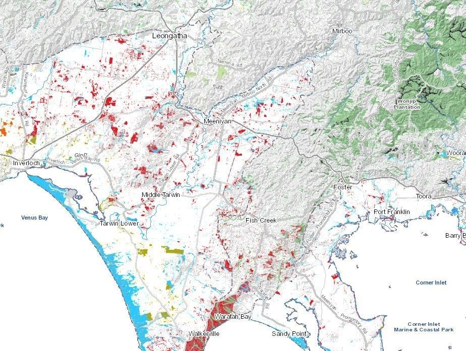
The Nerrena / Tarwin Valley Landcare group is the amalgamation of three original Landcare groups. The central western part of the group area (the old Nerrena LC group area) is predominantly Lowland forest, dominated by Messmate and and Peppermint trees. This forest type is still present on roadsides, as remnants in paddocks, and bush blocks. Where grazed the understory is usually missing and recruitment of new trees absent, as seedlings are eaten by stock. Eventually the remnants die back. The flatter areas around Stony Creek and Dumbalk are also Lowland forest.
In the Nerrena East area and the hills surrounding the Dumbalk district (the old Jindanook area) there was originally wet forest. The hills are steep, and the area has been extensively cleared. East of Stony Creek in the previously Stony Creek LC group area, the hills are likewise cleared wet forest. Blue gums in paddocks and roadside vegetation are clues to the original vegetation. Some sections have been classified as Damp Forest as they contain understory plants which are found in both Lowland forest and Wet Forest. These are usually in sheltered areas. Along the Tarwin River and it's tributaries Riparian vegetation is present. Strzelecki gum is important here as it mainly occurs in Gippsland.
There are areas of Bog gum Heathlands around the Stony Creek Racecourse, at Tarwin along the rail trail and south of the SG Highway towards Tarwin Lower. Bog gum is endemic to Victoria and has a limited distribution. The shire of South Gippsland is its stronghold. The different types of vegetation are known as Ecological Vegetation Classes. These broad classifications of original vegetation help us to understand what species we need to plant when planning a vegetation replacement or restoration project. Using the right native species for the area means they have a better chance of good growth, as conditions should be right for them to flourish. Native animals have also adapted to use specific types of native vegetation for food and shelter, so replanting, protecting remnants and enhancing native vegetation gives them the best chance of thriving.
Specifically on your farm, use the Nature kit mapping tool, link below, to work out what EVC is where on your property.
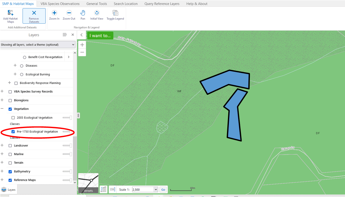
Finding the Ecological Vegetation Classes (EVC's) of your property
Here is link to the NatureKit Victoria interactive map. Use the map to find your property. Use the map to find the ecological vegetation classes (EVC) of the area chosen. Other online tools allow you to discover the EVC's of remnants and their status. You can measure and print maps as well.
Acknowledgement of Traditional Owners and Country
The Nerrena/Tarwin Valley Landcare group acknowledges the Traditional Owners of the Landcare group area and pays respect to their past and present Elders. We honour and celebrate the spiritual, cultural and customary connections of Traditional Owners to country and the biodiversity that forms part of that country.
Contact us
Phil Poulton, President
Phone: 0428 642 371
Email: ntvlandcare@gmail.com
Send us a message