NTVLC-02 Tarwin River crossing (middle bridge), Koonwarra
Link to Bird Life Australia Birdata Shared Site here
Survey type: 2ha, 20 minute search
Description
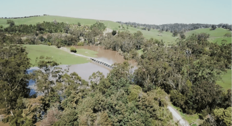
The monitoring site is a flood plain beside the Tarwin River. The site is mostly cattle grazing, with some wet areas with the river along one border. As this area is privately leased it is not currently part of the Blackspur Creek wetlands rehabilitation project. The roadworks, replanting and weed control works will have little impact on this area.
Site Location
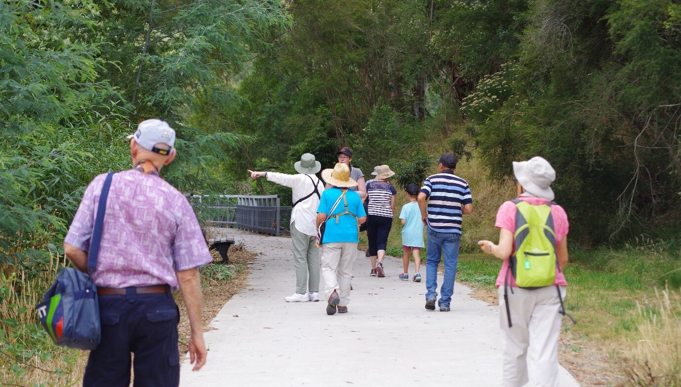
Getting there: Tarwin River crossing (middle bridge) is located south of Koonwarra. The site is accessed via the Great Southern Rail Trail. Either walk south down the rail trail from the Koonwarra township or the Recreation Reserve, or north from the Minns Road carpark.
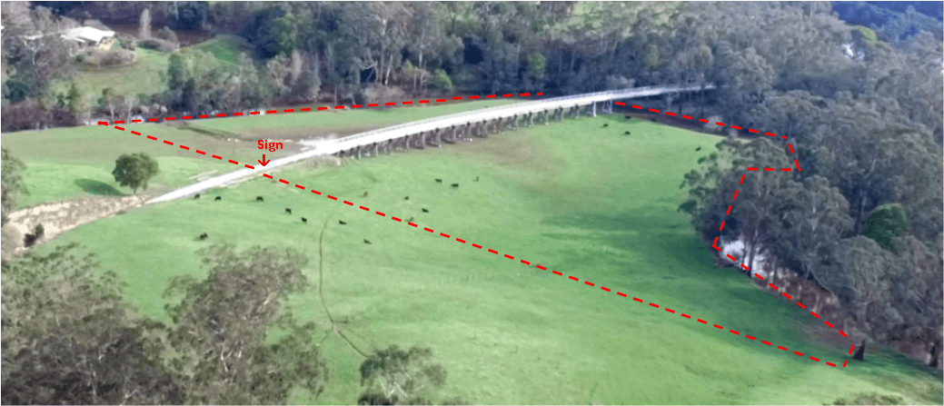
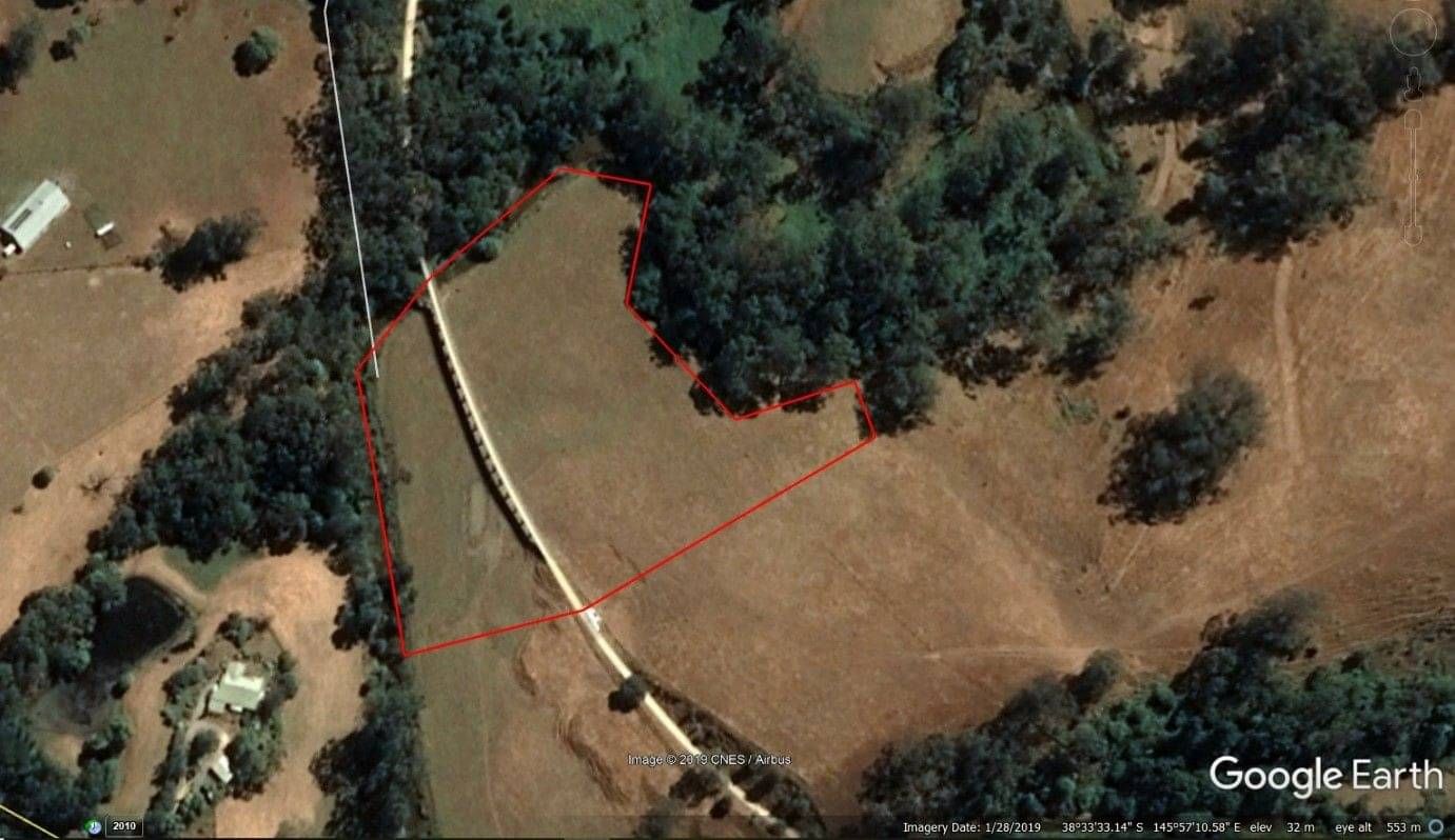
To get to the Recreation Reserve from Koonwarra, travel south on the South Gippsland Highway (A440) for 280 metres turn left then after 30 metres, right down Buckingham and Fowlers Road. The reserve is 225 metres on the left. Parking is available at the reserve and access to the rail trail is on the other side of Buckingham and Fowlers Road. The Tarwin River bridge is 1.2 kilometres along the rail trail. The monitoring site starts at the north bank of the Tarwin River and encompasses both sides of the rail trail for 145 metres until the Vicroads sign beside the rail trial on the east side. If approaching the site from the Minns Road Car park, enter the rail trail and travel 1.1 kilometres towards Koonwarra until the sign is reached. The monitoring site begins 100 metres from the end of site NTVLC-01, travelling south, or 130 metres from NTVLC-03 travelling north. All distances are approximate. As you walk across the bridge, the vista on both sides of the rail trail gives good views of pasture in this loop of the Tarwin River. To the west the site is the bounded by the river. It is possible to observe the whole monitoring site from the bridge.
Survey Method
20 Minute 2 Hectare search: walk along the bridge looking out over the pasture in both directions. The site is bordered by the river at the edge of the 2 Ha area on the north east side of the bridge, and the west and east boundaries. On the eastern side of the bridge the river is not included, but on the north west border the river is part of the site. A line drawn between the sign and the river to the west and the edge of a tree as shown on the map and in the guide photo is the southern boundary. This area is also a flood plain as the image shows, which is why the railway trestle bridge was constructed. Record the species present and the number of birds of each species.
Use the Birdata website or the Birdata phone app to record sightings. https://birdata.birdlife.org.a...
Acknowledgement of Traditional Owners and Country
The Nerrena/Tarwin Valley Landcare group acknowledges the Traditional Owners of the Landcare group area and pays respect to their past and present Elders. We honour and celebrate the spiritual, cultural and customary connections of Traditional Owners to country and the biodiversity that forms part of that country.
Contact us
Sue, Landcare group President
Phone 0432 379 119
Landcare group Secretary
Email: ntvlandcare@gmail.com
Mailing address:
105 Stockdales Road, Koonwarra 3954
Send us a message