We are proud to acknowledge the Bunurong/Boonwurrung people as the traditional owners of these lands and waters.
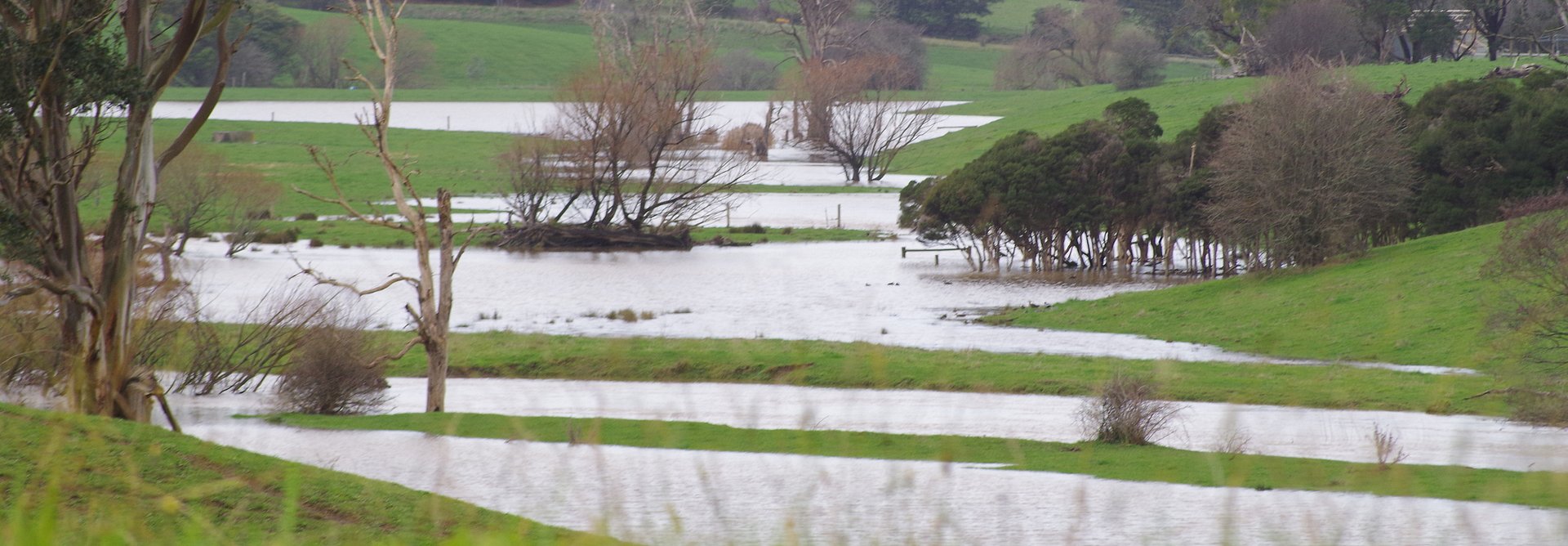
On Sunday we joined the throngs of people on the rail trail taking in the dynamic spectacle of our Tarwin River in flood – an extensive waterscape within the landscape, - refreshing, reinvigorating, renewing and regenerating. How fortunate we are to have this soaking!
Last Thursday, from the middle bridge, I watched entranced as a platypus repeatedly came to the surface and then dived into the river. Two Black Shouldered Kites were on their regular perches in an old dead tree. The ducks were out in force – Wood Ducks, Chestnut Teal, Grey Teal, Pacific Black Duck, a pair of Mountain Duck (Australian Shelduck) and Black Swans have all been seen in the past weeks. The 100 acre BSCW area is doing its job, slowing the flow and holding water in pools, billabongs and wetlands. It will do better as more drains are blocked and stock are excluded.
“Every community’s right to drinkable, fishable, swimmable water” is the focus of the global Waterkeeper Alliance (1). Recently I heard the Yarra Riverkeeper, Andrew Kelly, speak. He described himself as “A voice for a place.” He and his association advocate, educate and protect natural places (2). They tell the story of the river.
Perhaps every natural place needs a voice – someone speaking for it – and then things can happen. Local environmental assets are voiceless without their advocates - whether it’s the local Landcare or Friends group, a Progress Association or Native Plant or Conservation Society.
Nerrena Tarwin Valley Landcare Group “has over 150 km of West and East branch of the Tarwin River frontage contained in its borders, and many tributaries. The Tarwin River flows into Anderson's Inlet, a wetland of National Importance and East Asian-Australasian Shorebird Site.” (3) Much of the important work for river health starts high up in the catchment near the convergences, drainage lines and tributaries where water flows start. It’s often private land where farmers’ efforts to fence out stock and revegetate contribute.
Meanwhile, prior to commencement of the South Gippsland Highway realignment, salvage of cultural artefacts has continued through the winter. Bird monitoring also continues. Shared site data and information has been sent to Birdlife Australia for inclusion on the Birdata app and we are waiting for the shared sites to go live.
1 https://waterkeeper.org/ 2 http://yarrariver.org.au/
3 NTV L/C Group Action Plan 2017-2022. This and our Annual Reports and other plans and reports are available on our website.
TAGS
Black Spur Creek Wetlands Project (BSCW) - Update 15 August 2019
September 4, 2019
Acknowledgement of Traditional Owners and Country
The Nerrena/Tarwin Valley Landcare group acknowledges the Traditional Owners of the Landcare group area and pays respect to their past and present Elders. We honour and celebrate the spiritual, cultural and customary connections of Traditional Owners to country and the biodiversity that forms part of that country.
Contact us
Phil Poulton, President
Phone: 0428 642 371
Email: ntvlandcare@gmail.com
Send us a message